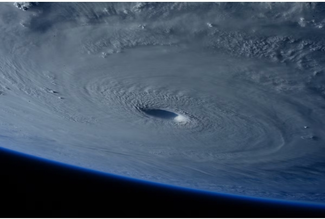
Hurricane Nolo, a Category 4 storm with 145 mph winds, was moving northwest about 415 miles west-southwest of Honolulu on the afternoon of Sept. 28 after passing south of the main Hawaiian Islands. Its rain flooded parts of the Big Island.
The National Hurricane Center’s 2 p.m. Hawaii time advisory, its Advisory 33A, put the storm’s center at 18.2 degrees north and 163.4 degrees west with a minimum pressure of 933 millibars.
The hurricane center forecast a gradual weakening trend beginning that night, followed by faster weakening through midweek. A hurricane warning is in effect for Papahanaumokuakea Marine National Monument from Nihoa to French Frigate Shoals, and hurricane conditions are possible there by Wednesday.
Hurricane Nolo’s Track and Strength
The storm strengthened quickly as it passed. At 2 p.m. Sunday, Sept. 27, the National Hurricane Center’s Advisory 29A put Nolo at 130 mph, about 375 miles south-southwest of Honolulu, and described it as rapidly intensifying. By 2 a.m. Monday, the center’s advisory put winds at 155 mph, just 2 mph below the 157 mph threshold for Category 5, and said the storm could reach that category. Winds later dropped to 145 mph.
Distance kept the strongest winds away from the main islands. At 2 a.m. Monday, hurricaneforce winds extended 35 miles from the center and tropical-storm-force winds extended 150 miles, according to that advisory. The center was 405 miles from Honolulu. That left about 255 miles between the edge of the tropical-storm-force winds and the city.
Weather.com reported that Nolo’s winds rose 55 mph in 24 hours and that it is the strongest hurricane to affect the Big Island in 67 years. Only Hurricane Dot in August 1959 passed within 150 miles as a major hurricane, weather.com said.
Rain, Outages and Closures On the Big Island
Rain totals differ by source. Weather.com reported more than 14 inches at the Big Island’s highest elevations. AccuWeather reported 17.25 inches at Spencer and 17.11 inches at Laupahoehoe over three days. The two outlets did not use the same observation sites.
The rain forecast for the rest of the state was lower. CBS News reported forecasts of 4 to 8 inches for Maui and 1 to 3 inches for the other islands. The National Hurricane Center’s Advisory 33 put the total at 3 to 6 inches for Kauai and Niihau.
Power outages topped 16,000 early Sunday, mostly on Maui, according to AccuWeather. By Sunday morning, Hawaii Public Radio counted more than 12,000 Maui customers, more than 4,000 Big Island customers and about 1,400 on Oahu without power. Flooding briefly closed Route 11, the Mamalahoa Highway, in Kau, and wind closed Route 250, Kohala Mountain Road. Hawaiian Electric shut off power in advance to about 485 customers in Pukalani. The Hawaii Department of Land and Natural Resources closed all state parks on the Big Island and Maui, CBS News reported.
Emergency Declaration and Shelters
President Donald Trump approved an emergency declaration Friday, Sept. 25, before the storm’s closest pass, according to PBS NewsHour. About 120 National Guard members were on the Big Island and about 400 statewide. The Hawaii Emergency Management Agency had three Hawaii County shelters open as of 8:30 a.m. Sunday: Ocean View Community Center, Naalehu Elementary School gym and Robert N. Herkes Gym.
“Don’t venture out if you don’t have to,” Michael Brennan, director of the National Hurricane Center, told PBS. The center’s forecasters said swells would affect south-facing shores for days and were “likely to cause life-threatening surf and rip current conditions,” CBS reported.
A Fourth Storm This Season
Nolo is the fourth significant weather system to threaten Hawaii this season, weather.com said, after hurricanes Lala and Lowell and Tropical Storm Moke. AccuWeather described it as the fourth tropical threat within six weeks. Hurricane Lala swept about 100 homes off their foundations on the Big Island in August, PBS reported, while AccuWeather said the storm destroyed about 100 homes. Lowell hit Kauai in early September, AccuWeather said.
The storm’s next target is the remote monument, which covers the northwestern Hawaiian Islands. Large waves could inundate low-lying atolls there, the hurricane center said in Advisory 29A.